 vesseltracker.com
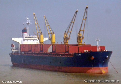
Galini
Current StatusWhere is the vessel?
Galini is currently in Near Tianjin Pt, based on AIS data received about 1h ago.
Latest AIS update:
Current position: 38.95580° N, 117.73478° E (Near Tianjin Pt)
Average speed (last 7 days): Loading…
Average speed (last 30 days): Loading…
Vessel profile: Galini is a Bulk Carrier with dimensions 31m x 190m.
This page combines live AIS, route history, probable destination signals, nearby traffic, and port activity for practical vessel monitoring.
The current position of vessel Galini is 38.95580 lat / 117.73478 lng. Updated: 2026-03-29 21:53:55 UTCNearest reference points:
- Near Tianjin Xingang Pt
- Near Tianjin Pt
- Near Dagu
Details:
Live Vessel Galini Analytics (details, animations, etc.)
Recent AIS points (UTC):
2026-03-29 15:23:55 UTC · 38.95580, 117.73472 · SOG 0 kn · COG 301°2026-03-29 17:35:55 UTC · 38.95586, 117.73477 · SOG 0 kn · COG 301°
2026-03-29 20:20:55 UTC · 38.95580, 117.73473 · SOG 0 kn · COG 301°
2026-03-29 21:53:55 UTC · 38.95580, 117.73478 · SOG 0 kn · COG 301°