 vesseltracker.com
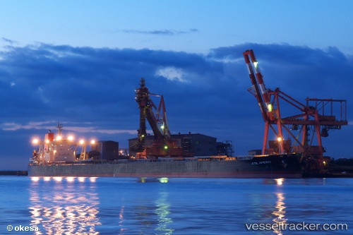
 XYMG NOBLE
Current Status
Where is the vessel?
XYMG NOBLE is currently in Near Qianwan, based on AIS data received about 1h ago.
Latest AIS update:
Current position: 36.03202° N, 120.22641° E (Near Qianwan)
Average speed (last 7 days): Loading…
Average speed (last 30 days): Loading…
Vessel profile: XYMG NOBLE is a Bulk Carrier with dimensions 50m x 300m.
This page combines live AIS, route history, probable destination signals, nearby traffic, and port activity for practical vessel monitoring.
The current position of vessel XYMG NOBLE is 36.03202 lat / 120.22641 lng. Updated: 2026-04-06 13:35:39 UTCNearest reference points:
- Near Xianlang
- Near Qingdao
- Near Jiaozhou
Currently sailing under the flag of Liberia ![]()
XYMG NOBLE built in 2004 year
Deadweight:
203272 tDetails:
Live Vessel XYMG NOBLE Analytics (details, animations, etc.)
Recent AIS points (UTC):
2026-04-06 08:11:34 UTC · 36.03207, 120.22636 · SOG 0 kn · COG 32°2026-04-06 10:12:29 UTC · 36.03167, 120.22500 · SOG 0 kn · COG -1°
2026-04-06 11:35:33 UTC · 36.03207, 120.22635 · SOG 0 kn · COG 32°
2026-04-06 13:35:39 UTC · 36.03202, 120.22641 · SOG 0 kn · COG 31°