 vesseltracker.com
 GELIBOLU
Current Status
Where is the vessel?
GELIBOLU is currently in 39 nm SW of Bangor, based on AIS data received less than 1h ago.
Latest AIS update:
Current position: 46.88725° N, 3.88662° W (39 nm SW of Bangor)
Average speed (last 7 days): Loading…
Average speed (last 30 days): Loading…
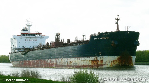
Vessel profile: GELIBOLU is a Oil/Chemical Tanker with dimensions m x m.
This page combines live AIS, route history, probable destination signals, nearby traffic, and port activity for practical vessel monitoring.
The current position of vessel GELIBOLU is 46.88725 lat / -3.88662 lng. Updated: 2026-04-21 05:49:58 UTCNearest reference points:
- Near Névez
- Near Saint-Pierre-Quiberon
- Near Sennecey-le-Grand
Currently sailing under the flag of Panama ![]()
Details:
Live Vessel GELIBOLU Analytics (details, animations, etc.)
Recent AIS points (UTC):
2026-04-21 01:48:26 UTC · 47.39668, -4.59387 · SOG 10.3 kn · COG 132°2026-04-21 04:07:58 UTC · 47.11847, -4.16754 · SOG 10.4 kn · COG 136°
2026-04-21 04:32:00 UTC · 47.06626, -4.09931 · SOG 10.6 kn · COG 137°
2026-04-21 05:49:58 UTC · 46.88725, -3.88662 · SOG 10.3 kn · COG 137°