 vesseltracker.com
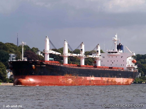
 Newseas Amber
Current Status
Where is the vessel?
Newseas Amber is currently in 16 nm SE of Tacloban, based on AIS data received about 19h ago.
Latest AIS update:
Current position: 11.03844° N, 125.16149° E (16 nm SE of Tacloban)
Average speed (last 7 days): Loading…
Average speed (last 30 days): Loading…
Vessel profile: Newseas Amber is a Bulk Carrier with dimensions 190m x 32m.
This page combines live AIS, route history, probable destination signals, nearby traffic, and port activity for practical vessel monitoring.
The current position of vessel Newseas Amber is 11.03844 lat / 125.16149 lng. Updated: 2026-04-19 17:31:12 UTCNearest reference points:
- Near Tacloban
- Near Hilongos
- 16 nm E of Danao
Currently sailing under the flag of Panama ![]()
Newseas Amber built in 2005 year
Deadweight:
52347 tDetails:
Live Vessel Newseas Amber Analytics (details, animations, etc.)
Recent AIS points (UTC):
2026-04-19 17:31:12 UTC · 11.03844, 125.16149 · SOG 0.3 kn · COG 354°2026-04-19 17:31:12 UTC · 11.03844, 125.16149 · SOG 0.3 kn · COG 354°
2026-04-19 17:31:12 UTC · 11.03844, 125.16149 · SOG 0.3 kn · COG 354°
2026-04-19 17:31:12 UTC · 11.03844, 125.16149 · SOG 0.3 kn · COG 354°