 vesseltracker.com
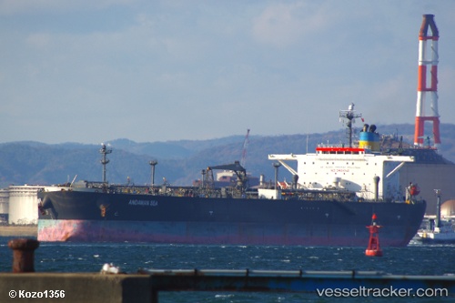
Ship 111
Current StatusWhere is the vessel?
Ship 111 is currently in 15 nm S of Exspan, based on AIS data received about 1h ago.
Latest AIS update:
Current position: 2.03924° S, 105.06520° E (15 nm S of Exspan)
Average speed (last 7 days): Loading…
Average speed (last 30 days): Loading…
Vessel profile: Ship 111 is a Crude Oil Tanker with dimensions 42m x 244m.
This page combines live AIS, route history, probable destination signals, nearby traffic, and port activity for practical vessel monitoring.
The current position of vessel Ship 111 is -2.03924 lat / 105.06520 lng. Updated: 2026-04-20 08:03:22 UTCNearest reference points:
- 36 nm SW of Exspan
- 38 nm SW of PANGKAL BALAM
- Near Kertapati
Details:
Live Vessel Ship 111 Analytics (details, animations, etc.)
Recent AIS points (UTC):
2026-04-20 04:42:23 UTC · -2.03505, 105.06431 · SOG 0 kn · COG 157°2026-04-20 06:15:22 UTC · -2.03527, 105.06452 · SOG 0.1 kn · COG 159°
2026-04-20 07:42:23 UTC · -2.03929, 105.06530 · SOG 0.1 kn · COG 358°
2026-04-20 08:03:22 UTC · -2.03924, 105.06520 · SOG 0 kn · COG 3°