 vesseltracker.com
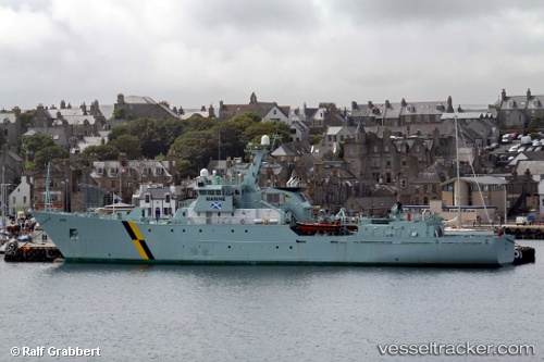
Jura
Current StatusWhere is the vessel?
Jura is currently in Near Garrabost, based on AIS data received about 23h ago.
Latest AIS update:
Current position: 58.12591° N, 6.18496° W (Near Garrabost)
Average speed (last 7 days): Loading…
Average speed (last 30 days): Loading…
Vessel profile: Jura is a Fishing Support Vessel with dimensions 14m x 84m.
This page combines live AIS, route history, probable destination signals, nearby traffic, and port activity for practical vessel monitoring.
The current position of vessel Jura is 58.12591 lat / -6.18496 lng. Updated: 2026-04-19 10:33:49 UTCNearest reference points:
- Near North Harris
- Near Culkein
- Near KYLE OF LOCHALSH
Details:
Live Vessel Jura Analytics (details, animations, etc.)
Recent AIS points (UTC):
2026-04-19 10:33:49 UTC · 58.12591, -6.18496 · SOG 10.6 kn · COG 120°2026-04-19 10:33:49 UTC · 58.12591, -6.18496 · SOG 10.6 kn · COG 120°
2026-04-19 10:33:49 UTC · 58.12591, -6.18496 · SOG 10.6 kn · COG 120°
2026-04-19 10:33:49 UTC · 58.12591, -6.18496 · SOG 10.6 kn · COG 120°