 vesseltracker.com
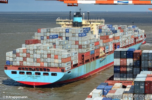
 Gjertrud Maersk
Current Status
Where is the vessel?
Gjertrud Maersk is currently in Near Yantian, based on AIS data received less than 1h ago.
Latest AIS update:
Current position: 22.56735° N, 114.27362° E (Near Yantian)
Average speed (last 7 days): Loading…
Average speed (last 30 days): Loading…
Vessel profile: Gjertrud Maersk is a Container Ship with dimensions 367m x 367m.
This page combines live AIS, route history, probable destination signals, nearby traffic, and port activity for practical vessel monitoring.
The current position of vessel Gjertrud Maersk is 22.56735 lat / 114.27362 lng. Updated: 2026-03-30 01:31:00 UTCNearest reference points:
- Near Yantian
- Near Shatoujiao
- Near Sai Kung
Currently sailing under the flag of Denmark ![]()
Gjertrud Maersk built in 2005 year
Deadweight:
115700 tDetails:
Live Vessel Gjertrud Maersk Analytics (details, animations, etc.)
Recent AIS points (UTC):
2026-03-29 20:24:00 UTC · 22.53363, 114.39138 · SOG 14.3 kn · COG 295°2026-03-29 21:55:00 UTC · 22.56737, 114.27353 · SOG 0 kn · COG 319°
2026-03-30 00:01:00 UTC · 22.56748, 114.27348 · SOG 0 kn · COG 319°
2026-03-30 01:31:00 UTC · 22.56735, 114.27362 · SOG 0 kn · COG 319°