 vesseltracker.com
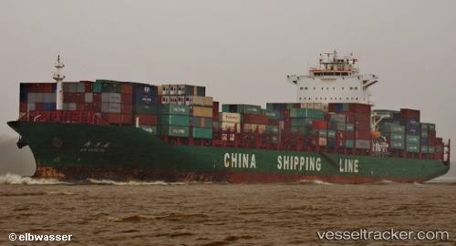
 Xin Yang Pu
Current Status
Where is the vessel?
Xin Yang Pu is currently in 103 nm NE of DAFENG, based on AIS data received about 2h ago.
Latest AIS update:
Current position: 34.52795° N, 122.23970° E (103 nm NE of DAFENG)
Average speed (last 7 days): Loading…
Average speed (last 30 days): Loading…
Vessel profile: Xin Yang Pu is a Container Ship with dimensions 263m x 263m.
This page combines live AIS, route history, probable destination signals, nearby traffic, and port activity for practical vessel monitoring.
The current position of vessel Xin Yang Pu is 34.52795 lat / 122.23970 lng. Updated: 2026-04-03 01:36:09 UTCNearest reference points:
- 89 nm NE of DAFENG
- 116 nm NE of DAFENG
- 103 nm NE of DAFENG
Currently sailing under the flag of China ![]()
Xin Yang Pu built in 2008 year
Deadweight:
52200 tDetails:
Live Vessel Xin Yang Pu Analytics (details, animations, etc.)
Recent AIS points (UTC):
2026-04-02 19:35:00 UTC · 35.46531, 121.00665 · SOG 12.4 kn · COG 160°2026-04-02 21:30:00 UTC · 35.14152, 121.36022 · SOG 14.3 kn · COG 134°
2026-04-02 23:27:55 UTC · 34.79473, 121.75568 · SOG 14.7 kn · COG 120°
2026-04-03 01:36:09 UTC · 34.52795, 122.23970 · SOG 12 kn · COG 130°