 vesseltracker.com
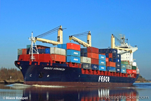
 Voronezh
Current Status
Where is the vessel?
Voronezh is currently in Near Petrolsport, based on AIS data received about 2h ago.
Latest AIS update:
Current position: 59.87158° N, 30.20670° E (Near Petrolsport)
Average speed (last 7 days): Loading…
Average speed (last 30 days): Loading…
Vessel profile: Voronezh is a Container Ship with dimensions 184m x 25m.
This page combines live AIS, route history, probable destination signals, nearby traffic, and port activity for practical vessel monitoring.
The current position of vessel Voronezh is 59.87158 lat / 30.20670 lng. Updated: 2026-04-07 19:30:33 UTCNearest reference points:
- Near Petrolsport
- Near Vassilevsky Ostrov/St Petersburg
- Near Sankt-Peterburg
Currently sailing under the flag of Cyprus ![]()
Voronezh built in 2008 year
Deadweight:
22749 tDetails:
Live Vessel Voronezh Analytics (details, animations, etc.)
Recent AIS points (UTC):
2026-04-06 16:59:56 UTC · 60.03173, 29.01704 · SOG 15.3 kn · COG 91°2026-04-07 15:51:12 UTC · 59.93817, 29.91949 · SOG 11.9 kn · COG 111°
2026-04-07 17:41:42 UTC · 59.87144, 30.20686 · SOG 0.6 kn · COG 316°
2026-04-07 19:30:33 UTC · 59.87158, 30.20670 · SOG 0.5 kn · COG 316°