 vesseltracker.com
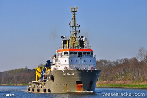
Kamara
Current StatusWhere is the vessel?
Kamara is currently in 14 nm NW of Oostende, based on AIS data received about 1h ago.
Latest AIS update:
Current position: 51.43158° N, 2.70971° E (14 nm NW of Oostende)
Average speed (last 7 days): Loading…
Average speed (last 30 days): Loading…
Vessel profile: Kamara is a Offshore Tug Supply Ship with dimensions 16m x 72m.
This page combines live AIS, route history, probable destination signals, nearby traffic, and port activity for practical vessel monitoring.
The current position of vessel Kamara is 51.43158 lat / 2.70971 lng. Updated: 2026-04-17 10:12:40 UTCNearest reference points:
- 13 nm NW of Middelkerke
- Near Oostende
- Near Lombardsijde
Details:
Live Vessel Kamara Analytics (details, animations, etc.)
Recent AIS points (UTC):
2026-04-17 03:44:30 UTC · 51.43174, 2.70638 · SOG 0.5 kn · COG 185°2026-04-17 05:34:40 UTC · 51.43160, 2.70622 · SOG 0.1 kn · COG 185°
2026-04-17 08:23:40 UTC · 51.43155, 2.71032 · SOG 0.1 kn · COG 64°
2026-04-17 10:12:40 UTC · 51.43158, 2.70971 · SOG 0 kn · COG 56°