 vesseltracker.com
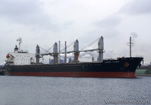
 Med Island
Current Status
Where is the vessel?
Med Island is currently in Near Kamaterón, based on AIS data received less than 1h ago.
Latest AIS update:
Current position: 37.87770° N, 23.54224° E (Near Kamaterón)
Average speed (last 7 days): Loading…
Average speed (last 30 days): Loading…
Vessel profile: Med Island is a Bulk Carrier with dimensions 170m x 27m.
This page combines live AIS, route history, probable destination signals, nearby traffic, and port activity for practical vessel monitoring.
The current position of vessel Med Island is 37.87770 lat / 23.54224 lng. Updated: 2026-04-02 05:21:11 UTCNearest reference points:
- Near PERAMA
- Near Drapetzona
- Near Keratsínion
Currently sailing under the flag of Malta ![]()
Med Island built in 2005 year
Deadweight:
28556 tDetails:
Live Vessel Med Island Analytics (details, animations, etc.)
Recent AIS points (UTC):
2026-04-01 23:30:12 UTC · 37.87669, 23.54221 · SOG 0.2 kn · COG 240°2026-04-02 01:42:12 UTC · 37.87597, 23.54224 · SOG 0.1 kn · COG 269°
2026-04-02 04:18:13 UTC · 37.87807, 23.54173 · SOG 0.7 kn · COG 245°
2026-04-02 05:21:11 UTC · 37.87770, 23.54224 · SOG 0.8 kn · COG 218°