 vesseltracker.com
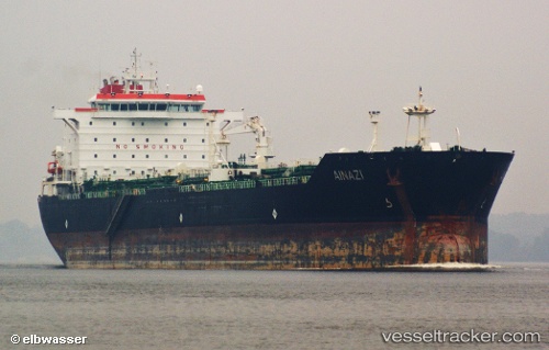
Ainazi
Current StatusWhere is the vessel?
Ainazi is currently in Near QUEBEC, based on AIS data received about 17h ago.
Latest AIS update:
Current position: 46.82873° N, 71.20046° W (Near QUEBEC)
Average speed (last 7 days): Loading…
Average speed (last 30 days): Loading…
Vessel profile: Ainazi is a Chemical Oil Products Tanker with dimensions 32m x 196m.
This page combines live AIS, route history, probable destination signals, nearby traffic, and port activity for practical vessel monitoring.
The current position of vessel Ainazi is 46.82873 lat / -71.20046 lng. Updated: 2026-04-02 22:40:28 UTCNearest reference points:
- Near QUEBEC
- Near Ile Aux Coudres
- Near Cap-de-la-Madeleine
Details:
Live Vessel Ainazi Analytics (details, animations, etc.)
Recent AIS points (UTC):
2026-04-02 22:08:18 UTC · 46.82934, -71.19285 · SOG 1.9 kn · COG 256°2026-04-02 22:40:28 UTC · 46.82873, -71.20046 · SOG 0.2 kn · COG -1°
2026-04-02 22:40:28 UTC · 46.82873, -71.20046 · SOG 0.2 kn · COG -1°
2026-04-02 22:40:28 UTC · 46.82873, -71.20046 · SOG 0.2 kn · COG -1°