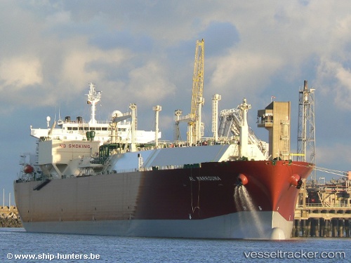
Al Marrouna
Current StatusWhere is the vessel?
Al Marrouna is currently in 16 nm W of Galle, based on AIS data received about 16h ago.
Latest AIS update:
Current position: 5.97333° N, 79.95333° E (16 nm W of Galle)
Average speed (last 7 days): Loading…
Average speed (last 30 days): Loading…
Vessel profile: Al Marrouna is a Lng Tanker with dimensions 44m x 288m.
This page combines live AIS, route history, probable destination signals, nearby traffic, and port activity for practical vessel monitoring.
The current position of vessel Al Marrouna is 5.97333 lat / 79.95333 lng. Updated: 2026-05-23 19:40:44 UTCNearest reference points:
- 19 nm SW of Bataduwa
- 38 nm SW of Galle
- 15 nm S of Koggala
Details:
Live Vessel Al Marrouna Analytics (details, animations, etc.)
Recent AIS points (UTC):
2026-05-23 16:25:41 UTC · 5.97333, 79.95500 · SOG 0 kn · COG -1°2026-05-23 17:52:19 UTC · 5.97351, 79.95492 · SOG 0.1 kn · COG 337°
2026-05-23 19:13:44 UTC · 5.97167, 79.95333 · SOG 0 kn · COG -1°
2026-05-23 19:40:44 UTC · 5.97333, 79.95333 · SOG 0 kn · COG -1°