 vesseltracker.com
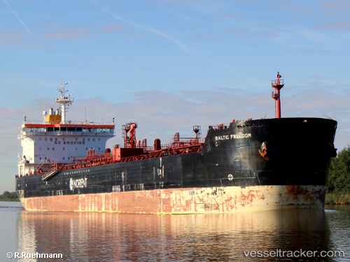
Vessel BALTIC STAR IMO: 9327396, MMSI: 636023657 Crude Oil Tanker
UTC, 59.15184, 21.62517, course: 215, speed: 11.2
UTC, 58.79147, 21.16272, course: 214, speed: 11.2
2026-03-24 21:51:58 UTC, 58.44496, 20.74083, course: 215, speed: 11.7
Live Vessel BALTIC STAR Analytics (details, animations, etc.)
Live AIS position: UTC. 36 nm W of Vikati Sadam), updated 2026-03-24 21:51:58 UTC.Find the position of the vessel BALTIC STAR on the map. The latter are known coordinates and path.
marine traffic ship tracker show on live map
The current position of vessel BALTIC STAR is 58.44496 lat / 20.74083 lng. Updated: 2026-03-24 21:51:58 UTCCurrently sailing under the flag of Liberia
BALTIC STAR built in 2006 year
Deadweight:
37048 tDetails:
Last coordinates of the vessel:
UTC, 59.26770, 21.92525, course: 233, speed: 11.3UTC, 59.15184, 21.62517, course: 215, speed: 11.2
UTC, 58.79147, 21.16272, course: 214, speed: 11.2
2026-03-24 21:51:58 UTC, 58.44496, 20.74083, course: 215, speed: 11.7