 vesseltracker.com
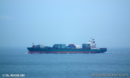
 AS CLAUDIA
Current Status
Where is the vessel?
AS CLAUDIA is currently in 26 nm N of Auderville, based on AIS data received less than 1h ago.
Latest AIS update:
Current position: 50.15244° N, 1.89175° W (26 nm N of Auderville)
Average speed (last 7 days): Loading…
Average speed (last 30 days): Loading…
Vessel profile: AS CLAUDIA is a Container Ship with dimensions m x m.
This page combines live AIS, route history, probable destination signals, nearby traffic, and port activity for practical vessel monitoring.
The current position of vessel AS CLAUDIA is 50.15244 lat / -1.89175 lng. Updated: 2026-04-06 00:11:57 UTCNearest reference points:
- 22 nm S of Holbury
- 11 nm SW of Holbury
- Near Équeurdreville
Currently sailing under the flag of Liberia ![]()
Details:
Live Vessel AS CLAUDIA Analytics (details, animations, etc.)
Recent AIS points (UTC):
2026-04-05 18:00:34 UTC · 50.52026, 0.09780 · SOG 15.4 kn · COG 257°2026-04-05 19:36:29 UTC · 50.42227, -0.50736 · SOG 14.2 kn · COG 252°
2026-04-05 21:41:17 UTC · 50.26644, -1.15011 · SOG 10.6 kn · COG 260°
2026-04-06 00:11:57 UTC · 50.15244, -1.89175 · SOG 13.3 kn · COG 258°