 vesseltracker.com
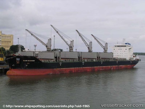
 Blue Diamond
Current Status
Where is the vessel?
Blue Diamond is currently in Near Waterport, based on AIS data received about 1h ago.
Latest AIS update:
Current position: 36.07875° N, 5.27058° W (Near Waterport)
Average speed (last 7 days): Loading…
Average speed (last 30 days): Loading…
Vessel profile: Blue Diamond is a Bulk Carrier with dimensions 190m x 32m.
This page combines live AIS, route history, probable destination signals, nearby traffic, and port activity for practical vessel monitoring.
The current position of vessel Blue Diamond is 36.07875 lat / -5.27058 lng. Updated: 2026-03-31 21:46:32 UTCNearest reference points:
- Near Waterport
- Near La Línea de la Concepción
- Near Palmones
Currently sailing under the flag of Liberia ![]()
Blue Diamond built in 2008 year
Deadweight:
53538 tDetails:
Live Vessel Blue Diamond Analytics (details, animations, etc.)
Recent AIS points (UTC):
2026-03-31 15:22:17 UTC · 36.12542, -5.36284 · SOG 0 kn · COG 279°2026-03-31 18:09:25 UTC · 36.12666, -5.36306 · SOG 0.3 kn · COG 217°
2026-03-31 19:51:16 UTC · 36.12425, -5.36713 · SOG 0.1 kn · COG 24°
2026-03-31 21:46:32 UTC · 36.07875, -5.27058 · SOG 11 kn · COG 100°