 vesseltracker.com
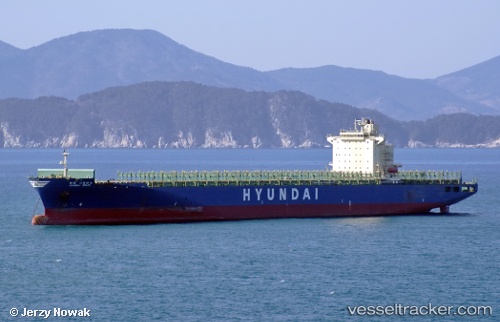
 Hyundai Grace
Current Status
Where is the vessel?
Hyundai Grace is currently in 56 nm E of Mipo/Ulsan, based on AIS data received about 2h ago.
Latest AIS update:
Current position: 35.54020° N, 130.57285° E (56 nm E of Mipo/Ulsan)
Average speed (last 7 days): Loading…
Average speed (last 30 days): Loading…
Vessel profile: Hyundai Grace is a Container Ship with dimensions 294m x 294m.
This page combines live AIS, route history, probable destination signals, nearby traffic, and port activity for practical vessel monitoring.
The current position of vessel Hyundai Grace is 35.54020 lat / 130.57285 lng. Updated: 2026-04-02 23:23:42 UTCNearest reference points:
- 21 nm E of Guryongpo
- 23 nm SE of Guryongpo
- 27 nm SE of ONSAN
Currently sailing under the flag of Marshall Is ![]()
Hyundai Grace built in 2007 year
Deadweight:
63439 tDetails:
Live Vessel Hyundai Grace Analytics (details, animations, etc.)
Recent AIS points (UTC):
2026-04-02 18:12:53 UTC · 36.26245, 131.69501 · SOG 13.4 kn · COG -1°2026-04-02 19:23:04 UTC · 36.11452, 131.42273 · SOG 13.3 kn · COG -1°
2026-04-02 21:25:40 UTC · 35.84145, 130.96765 · SOG 13.7 kn · COG -1°
2026-04-02 23:23:42 UTC · 35.54020, 130.57285 · SOG 13.5 kn · COG -1°