 vesseltracker.com
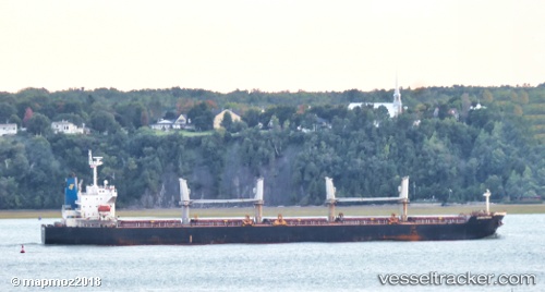
 Christinab
Current Status
Where is the vessel?
Christinab is currently in Near Hulaylah Terminal, based on AIS data received about 20h ago.
Latest AIS update:
Current position: 26.03488° N, 55.81683° E (Near Hulaylah Terminal)
Average speed (last 7 days): Loading…
Average speed (last 30 days): Loading…
Vessel profile: Christinab is a Ore Carrier with dimensions 190m x 190m.
This page combines live AIS, route history, probable destination signals, nearby traffic, and port activity for practical vessel monitoring.
The current position of vessel Christinab is 26.03488 lat / 55.81683 lng. Updated: 2026-04-10 04:49:49 UTCNearest reference points:
- Near Hulaylah Terminal
- 13 nm NW of Hulaylah Terminal
- Near Stevin Rock
Currently sailing under the flag of Marshall Is ![]()
Christinab built in 2007 year
Deadweight:
56071 tDetails:
Live Vessel Christinab Analytics (details, animations, etc.)
Recent AIS points (UTC):
2026-04-10 02:27:27 UTC · 26.03470, 55.81443 · SOG 0.1 kn · COG 142°2026-04-10 03:57:29 UTC · 26.03468, 55.81697 · SOG 0 kn · COG 231°
2026-04-10 04:49:49 UTC · 26.03488, 55.81683 · SOG 0.2 kn · COG -1°
2026-04-10 04:49:49 UTC · 26.03488, 55.81683 · SOG 0.2 kn · COG -1°