 vesseltracker.com
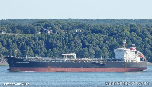
 LILA MIAMI
Current Status
Where is the vessel?
LILA MIAMI is currently in 134 nm SW of Ljubescica, based on AIS data received about 1h ago.
Latest AIS update:
Current position: 44.81092° N, 160.03271° E (134 nm SW of Ljubescica)
Average speed (last 7 days): Loading…
Average speed (last 30 days): Loading…
Vessel profile: LILA MIAMI is a Oil/Chemical Tanker with dimensions m x m.
This page combines live AIS, route history, probable destination signals, nearby traffic, and port activity for practical vessel monitoring.
The current position of vessel LILA MIAMI is 44.81092 lat / 160.03271 lng. Updated: 2026-04-19 19:37:07 UTCCurrently sailing under the flag of Liberia ![]()
Details:
Live Vessel LILA MIAMI Analytics (details, animations, etc.)
Recent AIS points (UTC):
2026-04-19 16:23:07 UTC · 44.70685, 159.00948 · SOG 13.3 kn · COG 79°2026-04-19 17:45:19 UTC · 44.75287, 159.44136 · SOG 13.7 kn · COG 81°
2026-04-19 19:28:23 UTC · 44.80500, 159.98500 · SOG 13 kn · COG -1°
2026-04-19 19:37:07 UTC · 44.81092, 160.03271 · SOG 13.6 kn · COG 80°