 vesseltracker.com
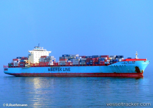
 Maersk Kinloss
Current Status
Where is the vessel?
Maersk Kinloss is currently in Near Busan New Port, based on AIS data received less than 1h ago.
Latest AIS update:
Current position: 35.07744° N, 128.81628° E (Near Busan New Port)
Average speed (last 7 days): Loading…
Average speed (last 30 days): Loading…
Vessel profile: Maersk Kinloss is a Container Ship with dimensions 300m x 300m.
This page combines live AIS, route history, probable destination signals, nearby traffic, and port activity for practical vessel monitoring.
The current position of vessel Maersk Kinloss is 35.07744 lat / 128.81628 lng. Updated: 2026-04-08 19:30:59 UTCNearest reference points:
- Near BUSAN NEW PORT
- Near Jinhae
- Near Gamcheon/Busan
Currently sailing under the flag of USA ![]()
Maersk Kinloss built in 2008 year
Deadweight:
84835 tDetails:
Live Vessel Maersk Kinloss Analytics (details, animations, etc.)
Recent AIS points (UTC):
2026-04-08 13:31:09 UTC · 35.07744, 128.81628 · SOG 0 kn · COG -1°2026-04-08 15:55:00 UTC · 35.07744, 128.81630 · SOG 0 kn · COG 90°
2026-04-08 17:58:00 UTC · 35.07743, 128.81630 · SOG 0 kn · COG 90°
2026-04-08 19:30:59 UTC · 35.07744, 128.81628 · SOG 0 kn · COG 90°