 vesseltracker.com
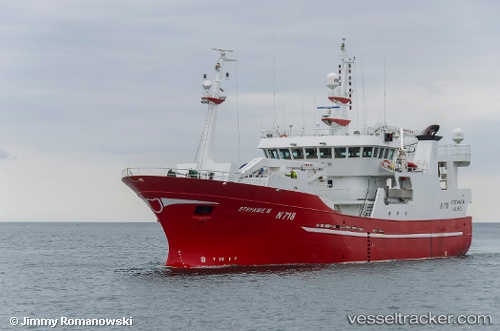
 Stefanie M
Current Status
Where is the vessel?
Stefanie M is currently in 30 nm W of Ham Voe, Foula, based on AIS data received about 77d ago.
Latest AIS update:
Current position: 60.08667° N, 3.04500° W (30 nm W of Ham Voe, Foula)
Average speed (last 7 days): Loading…
Average speed (last 30 days): Loading…
Vessel profile: Stefanie M is a Fish Carrier with dimensions 51m x 11m.
This page combines live AIS, route history, probable destination signals, nearby traffic, and port activity for practical vessel monitoring.
The current position of vessel Stefanie M is 60.08667 lat / -3.04500 lng. Updated: 2026-01-08 03:38:39 UTCNearest reference points:
- 36 nm NW of Ham Voe, Foula
- 32 nm NW of Eshaness
- Near Tingwall
Currently sailing under the flag of United Kingdom ![]()
Stefanie M built in 2005 year
Deadweight:
992 tDetails:
Live Vessel Stefanie M Analytics (details, animations, etc.)
Recent AIS points (UTC):
2026-01-08 03:38:39 UTC · 60.08667, -3.04500 · SOG 9 kn · COG -1°