 vesseltracker.com
Port Gc9a
Current StatusWhere is the vessel?
Port Gc9a is currently in 29 nm SW of Harper, based on AIS data received about 1h ago.
Latest AIS update:
Current position: 4.04500° N, 8.06833° W (29 nm SW of Harper)
Average speed (last 7 days): Loading…
Average speed (last 30 days): Loading…
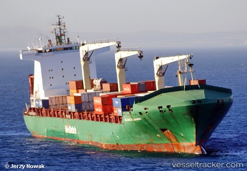
Vessel profile: Port Gc9a is a Container Ship with dimensions 32m x 221m.
This page combines live AIS, route history, probable destination signals, nearby traffic, and port activity for practical vessel monitoring.
The current position of vessel Port Gc9a is 4.045 lat / -8.06833 lng. Updated: 2026-04-18 21:24:29 UTCNearest reference points:
- 98 nm SW of Harper
- 160 nm S of Harper
- 15 nm SW of Buchanan
Details:
Live Vessel Port Gc9a Analytics (details, animations, etc.)
Recent AIS points (UTC):
2026-04-18 15:21:30 UTC · 3.92500, -6.60333 · SOG 15 kn · COG -1°2026-04-18 17:24:16 UTC · 3.93136, -7.13221 · SOG 16 kn · COG 274°
2026-04-18 20:19:19 UTC · 4.00313, -7.81954 · SOG 14.2 kn · COG 279°
2026-04-18 21:24:29 UTC · 4.04500, -8.06833 · SOG 13 kn · COG -1°