 vesseltracker.com
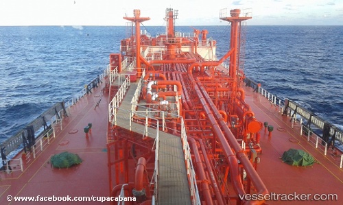
 Rhourd El Hamra
Current Status
Where is the vessel?
Rhourd El Hamra is currently in Near Annaba, based on AIS data received less than 1h ago.
Latest AIS update:
Current position: 36.90908° N, 7.81711° E (Near Annaba)
Average speed (last 7 days): Loading…
Average speed (last 30 days): Loading…
Vessel profile: Rhourd El Hamra is a Lpg Tanker with dimensions 156m x 25m.
This page combines live AIS, route history, probable destination signals, nearby traffic, and port activity for practical vessel monitoring.
The current position of vessel Rhourd El Hamra is 36.90908 lat / 7.81711 lng. Updated: 2026-04-05 12:05:00 UTCNearest reference points:
- Near Annaba
- Near Skikid
- 35 nm S of Setubal
Currently sailing under the flag of Algeria ![]()
Rhourd El Hamra built in 2008 year
Deadweight:
19277 tDetails:
Live Vessel Rhourd El Hamra Analytics (details, animations, etc.)
Recent AIS points (UTC):
2026-04-05 06:17:00 UTC · 36.91172, 7.81832 · SOG 0 kn · COG 241°2026-04-05 08:04:59 UTC · 36.91154, 7.81829 · SOG 0 kn · COG 249°
2026-04-05 09:41:02 UTC · 36.91014, 7.81847 · SOG 0 kn · COG 298°
2026-04-05 12:05:00 UTC · 36.90908, 7.81711 · SOG 0 kn · COG 352°