 vesseltracker.com
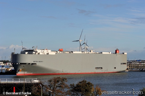
Georgia Highway
Current StatusWhere is the vessel?
Georgia Highway is currently in Near Corinto, based on AIS data received about 1h ago.
Latest AIS update:
Current position: 12.52035° N, 87.29685° W (Near Corinto)
Average speed (last 7 days): Loading…
Average speed (last 30 days): Loading…
Vessel profile: Georgia Highway is a Vehicles Carrier with dimensions 32m x 200m.
This page combines live AIS, route history, probable destination signals, nearby traffic, and port activity for practical vessel monitoring.
The current position of vessel Georgia Highway is 12.52035 lat / -87.29685 lng. Updated: 2026-03-30 13:40:13 UTCNearest reference points:
- Near El Salvador
- 27 nm W of Playa Conchal
- Near Golfo de Papagayo
Details:
Live Vessel Georgia Highway Analytics (details, animations, etc.)
Recent AIS points (UTC):
2026-03-30 07:46:17 UTC · 12.52028, -87.29700 · SOG 0.1 kn · COG 125°2026-03-30 09:40:13 UTC · 12.52022, -87.29695 · SOG 0.2 kn · COG 133°
2026-03-30 11:53:11 UTC · 12.52038, -87.29688 · SOG 0 kn · COG 104°
2026-03-30 13:40:13 UTC · 12.52035, -87.29685 · SOG 0.1 kn · COG 128°