 vesseltracker.com
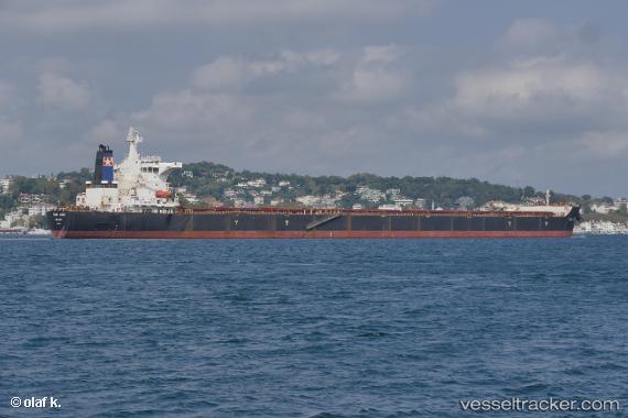
 STAR ANGIE
Current Status
Where is the vessel?
STAR ANGIE is currently in Open sea (no nearby ports in database), based on AIS data received less than 1h ago.
Latest AIS update:
Current position: 34.95526° S, 79.01599° E (Open sea (no nearby ports in database))
Average speed (last 7 days): Loading…
Average speed (last 30 days): Loading…
Vessel profile: STAR ANGIE is a Bulk Carrier with dimensions 45m x 292m.
This page combines live AIS, route history, probable destination signals, nearby traffic, and port activity for practical vessel monitoring.
The current position of vessel STAR ANGIE is -34.95526 lat / 79.01599 lng. Updated: 2026-04-21 22:22:12 UTCNearest reference points:
- Open sea (no nearby ports in database)
Currently sailing under the flag of Liberia ![]()
STAR ANGIE built in 2007 year
Deadweight:
177932 tDetails:
Live Vessel STAR ANGIE Analytics (details, animations, etc.)
Recent AIS points (UTC):
2026-04-21 19:30:15 UTC · -34.94789, 79.71015 · SOG 11.9 kn · COG 270°2026-04-21 19:35:25 UTC · -34.94667, 79.68833 · SOG 11 kn · COG -1°
2026-04-21 21:40:52 UTC · -34.95340, 79.18282 · SOG 11.9 kn · COG 269°
2026-04-21 22:22:12 UTC · -34.95526, 79.01599 · SOG 11.8 kn · COG 272°