 vesseltracker.com
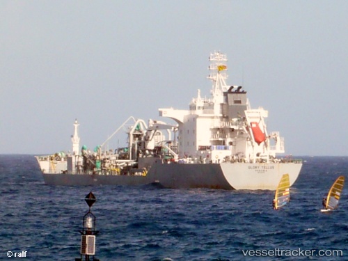
 TELLUS
Current Status
Where is the vessel?
TELLUS is currently in Near Barra dos Coqueiros, based on AIS data received less than 1h ago.
Latest AIS update:
Current position: 10.84368° S, 36.91908° W (Near Barra dos Coqueiros)
Average speed (last 7 days): Loading…
Average speed (last 30 days): Loading…
Vessel profile: TELLUS is a Cement Carrier with dimensions 142m x 25m.
This page combines live AIS, route history, probable destination signals, nearby traffic, and port activity for practical vessel monitoring.
The current position of vessel TELLUS is -10.84368 lat / -36.91908 lng. Updated: 2026-04-09 22:13:47 UTCNearest reference points:
- Near Barra dos Coqueiros
- Near Aracaju
- Near Suape
Currently sailing under the flag of Liberia ![]()
TELLUS built in 2006 year
Deadweight:
20200 tDetails:
Live Vessel TELLUS Analytics (details, animations, etc.)
Recent AIS points (UTC):
2026-04-09 16:10:43 UTC · -10.84368, -36.91913 · SOG 0 kn · COG 28°2026-04-09 18:07:47 UTC · -10.84365, -36.91915 · SOG 0 kn · COG 28°
2026-04-09 20:07:41 UTC · -10.84368, -36.91910 · SOG 0 kn · COG 29°
2026-04-09 22:13:47 UTC · -10.84368, -36.91908 · SOG 0 kn · COG 28°