 vesseltracker.com
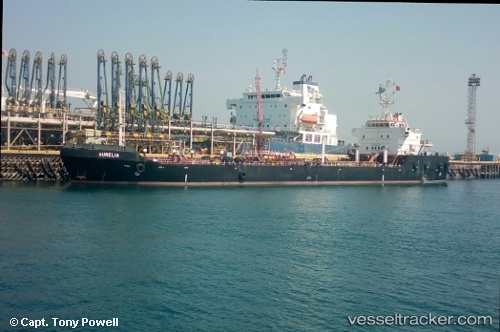
 ICONIC 1
Current Status
Where is the vessel?
ICONIC 1 is currently in Near KHORFAKKAN, based on AIS data received about 1d ago.
Latest AIS update:
Current position: 25.39590° N, 56.48781° E (Near KHORFAKKAN)
Average speed (last 7 days): Loading…
Average speed (last 30 days): Loading…
Vessel profile: ICONIC 1 is a Oil Products Tanker with dimensions m x m.
This page combines live AIS, route history, probable destination signals, nearby traffic, and port activity for practical vessel monitoring.
The current position of vessel ICONIC 1 is 25.39590 lat / 56.48781 lng. Updated: 2026-04-10 04:43:08 UTCNearest reference points:
- Near KHORFAKKAN
- Near Offshore Fujairah
- Near Fujairah
Currently sailing under the flag of Cook Islands ![]()
Details:
Live Vessel ICONIC 1 Analytics (details, animations, etc.)
Recent AIS points (UTC):
2026-04-10 02:26:13 UTC · 25.40024, 56.43620 · SOG 0.1 kn · COG 162°2026-04-10 03:59:31 UTC · 25.40306, 56.45074 · SOG 5 kn · COG 81°
2026-04-10 04:43:08 UTC · 25.39590, 56.48781 · SOG 0.4 kn · COG -1°
2026-04-10 04:43:08 UTC · 25.39590, 56.48781 · SOG 0.4 kn · COG -1°