 vesseltracker.com
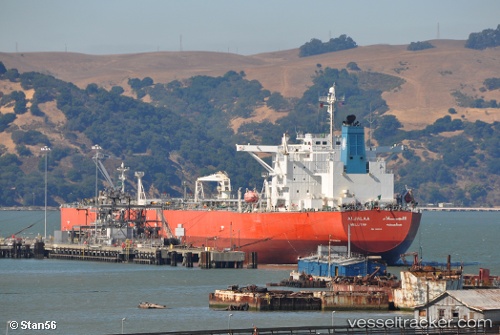
 ALJALAA
Current Status
Where is the vessel?
ALJALAA is currently in Near Majistan/Zhoushan, based on AIS data received about 1h ago.
Latest AIS update:
Current position: 30.11419° N, 122.17493° E (Near Majistan/Zhoushan)
Average speed (last 7 days): Loading…
Average speed (last 30 days): Loading…
Vessel profile: ALJALAA is a Crude Oil Tanker with dimensions m x m.
This page combines live AIS, route history, probable destination signals, nearby traffic, and port activity for practical vessel monitoring.
The current position of vessel ALJALAA is 30.11419 lat / 122.17493 lng. Updated: 2026-04-20 04:23:30 UTCNearest reference points:
- Near Majistan/Zhoushan
- Near JINHAI HEAVY INDUSTR
- Near ZHOUSHAN
Currently sailing under the flag of Marshall Islands ![]()
Details:
Live Vessel ALJALAA Analytics (details, animations, etc.)
Recent AIS points (UTC):
2026-04-20 02:06:10 UTC · 30.11420, 122.17493 · SOG 0 kn · COG 175°2026-04-20 02:24:28 UTC · 30.11419, 122.17491 · SOG 0 kn · COG 175°
2026-04-20 04:16:01 UTC · 30.11421, 122.17493 · SOG 0 kn · COG 175°
2026-04-20 04:23:30 UTC · 30.11419, 122.17493 · SOG 0 kn · COG 175°