 vesseltracker.com
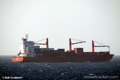
 S Mermaid
Current Status
Where is the vessel?
S Mermaid is currently in Near Gonglu, based on AIS data received less than 1h ago.
Latest AIS update:
Current position: 31.24685° N, 121.77298° E (Near Gonglu)
Average speed (last 7 days): Loading…
Average speed (last 30 days): Loading…
Vessel profile: S Mermaid is a General Cargo Ship with dimensions 81m x 14m.
This page combines live AIS, route history, probable destination signals, nearby traffic, and port activity for practical vessel monitoring.
The current position of vessel S Mermaid is 31.24685 lat / 121.77298 lng. Updated: 2026-04-19 06:01:08 UTCNearest reference points:
- Near Gonglu
- Near Jinqiao
- Near Wu-Sung
Currently sailing under the flag of Korea ![]()
Details:
Live Vessel S Mermaid Analytics (details, animations, etc.)
Recent AIS points (UTC):
2026-04-18 23:47:03 UTC · 31.79825, 120.95665 · SOG 10.9 kn · COG 129°2026-04-19 02:08:09 UTC · 31.52705, 121.36368 · SOG 10.4 kn · COG 122°
2026-04-19 03:53:18 UTC · 31.38222, 121.58418 · SOG 5.6 kn · COG 117°
2026-04-19 06:01:08 UTC · 31.24685, 121.77298 · SOG 7.1 kn · COG 140°