 vesseltracker.com
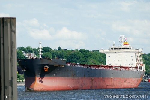
 HC ENERGY
Current Status
Where is the vessel?
HC ENERGY is currently in 39 nm E of Sabahat, based on AIS data received less than 1h ago.
Latest AIS update:
Current position: 4.88860° N, 119.66765° E (39 nm E of Sabahat)
Average speed (last 7 days): Loading…
Average speed (last 30 days): Loading…
Vessel profile: HC ENERGY is a Bulk Carrier with dimensions 225m x 225m.
This page combines live AIS, route history, probable destination signals, nearby traffic, and port activity for practical vessel monitoring.
The current position of vessel HC ENERGY is 4.88860 lat / 119.66765 lng. Updated: 2026-04-13 13:23:41 UTCNearest reference points:
- 80 nm SE of Labuan Haji
- 66 nm W of Jolo
- 43 nm E of Sibuko Bay
Currently sailing under the flag of Liberia ![]()
HC ENERGY built in 2006 year
Deadweight:
73594 tDetails:
Live Vessel HC ENERGY Analytics (details, animations, etc.)
Recent AIS points (UTC):
2026-04-13 07:19:45 UTC · 3.77122, 119.54604 · SOG 11.1 kn · COG -1°2026-04-13 09:51:30 UTC · 4.23631, 119.60973 · SOG 10.6 kn · COG -1°
2026-04-13 11:47:14 UTC · 4.59250, 119.66247 · SOG 11.3 kn · COG -1°
2026-04-13 13:23:41 UTC · 4.88860, 119.66765 · SOG 10.3 kn · COG -1°