 vesseltracker.com
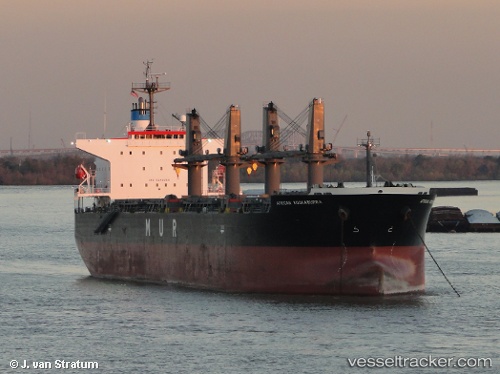
 LUMOSO BERKAT
Current Status
Where is the vessel?
LUMOSO BERKAT is currently in Near Taboneo, based on AIS data received about 2h ago.
Latest AIS update:
Current position: 3.74662° S, 114.42920° E (Near Taboneo)
Average speed (last 7 days): Loading…
Average speed (last 30 days): Loading…
Vessel profile: LUMOSO BERKAT is a Bulk Carrier with dimensions 24m x 6m.
This page combines live AIS, route history, probable destination signals, nearby traffic, and port activity for practical vessel monitoring.
The current position of vessel LUMOSO BERKAT is -3.74662 lat / 114.42920 lng. Updated: 2026-03-31 07:39:21 UTCNearest reference points:
- Near Taboneo
- Near BANJARMASIN
- Near Bunati
Currently sailing under the flag of Indonesia ![]()
LUMOSO BERKAT built in 2007 year
Deadweight:
55610 tDetails:
Live Vessel LUMOSO BERKAT Analytics (details, animations, etc.)
Recent AIS points (UTC):
2026-03-31 01:45:17 UTC · -3.74967, 114.43110 · SOG 0.1 kn · COG 350°2026-03-31 02:57:20 UTC · -3.74964, 114.43117 · SOG 0.1 kn · COG 348°
2026-03-31 05:48:17 UTC · -3.74856, 114.43251 · SOG 0 kn · COG 293°
2026-03-31 07:39:21 UTC · -3.74662, 114.42920 · SOG 0.1 kn · COG 121°