 vesseltracker.com
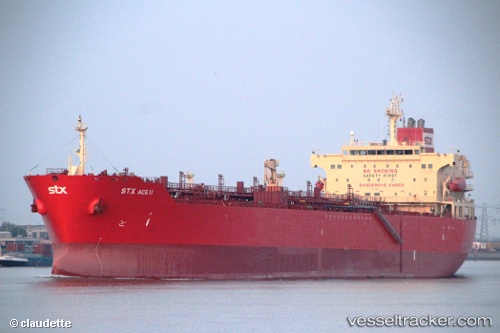
 FOS ENERGY
Current Status
Where is the vessel?
FOS ENERGY is currently in 47 nm NE of KIJANG, based on AIS data received less than 1h ago.
Latest AIS update:
Current position: 1.53475° N, 105.00838° E (47 nm NE of KIJANG)
Average speed (last 7 days): Loading…
Average speed (last 30 days): Loading…
Vessel profile: FOS ENERGY is a Chemical/Oil Products Tanker with dimensions 32m x 183m.
This page combines live AIS, route history, probable destination signals, nearby traffic, and port activity for practical vessel monitoring.
The current position of vessel FOS ENERGY is 1.53475 lat / 105.00838 lng. Updated: 2026-04-12 19:21:58 UTCNearest reference points:
- 47 nm NE of PENGERANG
- 38 nm E of PENGERANG
- 34 nm NE of PENGERANG
Currently sailing under the flag of Marshall Islands ![]()
FOS ENERGY built in 2006 year
Deadweight:
45990 tDetails:
Live Vessel FOS ENERGY Analytics (details, animations, etc.)
Recent AIS points (UTC):
2026-04-12 13:29:24 UTC · 0.79925, 105.78265 · SOG 10.8 kn · COG -1°2026-04-12 15:43:59 UTC · 1.10988, 105.51001 · SOG 10.9 kn · COG 323°
2026-04-12 18:01:27 UTC · 1.42392, 105.22858 · SOG 11.1 kn · COG -1°
2026-04-12 19:21:58 UTC · 1.53475, 105.00838 · SOG 11.6 kn · COG -1°