 vesseltracker.com
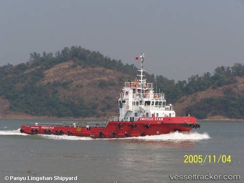
Sami Tide 3000
Current StatusWhere is the vessel?
Sami Tide 3000 is currently in Near POHL, based on AIS data received about 1h ago.
Latest AIS update:
Current position: 26.95229° N, 55.75212° E (Near POHL)
Average speed (last 7 days): Loading…
Average speed (last 30 days): Loading…
Vessel profile: Sami Tide 3000 is a Offshore Tug Supply Ship with dimensions 23m x 32m.
This page combines live AIS, route history, probable destination signals, nearby traffic, and port activity for practical vessel monitoring.
The current position of vessel Sami Tide 3000 is 26.95229 lat / 55.75212 lng. Updated: 2026-04-18 01:25:35 UTCNearest reference points:
- Near POHL
- Near Shahid Rajaee Pt/Bandar Abbas
- Near RAJAEI
Details:
Live Vessel Sami Tide 3000 Analytics (details, animations, etc.)
Recent AIS points (UTC):
2026-04-17 18:50:20 UTC · 26.95227, 55.75205 · SOG 0 kn · COG -1°2026-04-17 22:07:51 UTC · 26.95233, 55.75213 · SOG 0.1 kn · COG -1°
2026-04-18 00:06:21 UTC · 26.95228, 55.75213 · SOG 0 kn · COG -1°
2026-04-18 01:25:35 UTC · 26.95229, 55.75212 · SOG 0 kn · COG -1°