 vesseltracker.com
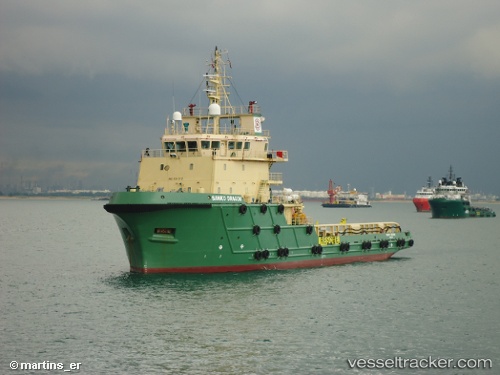
 Topaz Rayyan
Current Status
Where is the vessel?
Topaz Rayyan is currently in Near Al Hamriyah, based on AIS data received less than 1h ago.
Latest AIS update:
Current position: 25.46677° N, 55.50556° E (Near Al Hamriyah)
Average speed (last 7 days): Loading…
Average speed (last 30 days): Loading…
Vessel profile: Topaz Rayyan is a Offshore Tug Supply Ship with dimensions 70m x 17m.
This page combines live AIS, route history, probable destination signals, nearby traffic, and port activity for practical vessel monitoring.
The current position of vessel Topaz Rayyan is 25.46677 lat / 55.50556 lng. Updated: 2026-04-09 01:42:11 UTCNearest reference points:
- Near Al Hamriyah
- Near AJMAN
- Near Sharjah
Currently sailing under the flag of Marshall Is ![]()
Topaz Rayyan built in 2005 year
Deadweight:
2369 tDetails:
Live Vessel Topaz Rayyan Analytics (details, animations, etc.)
Recent AIS points (UTC):
2026-04-08 00:44:16 UTC · 25.46672, 55.50562 · SOG 0.2 kn · COG -1°2026-04-08 00:44:16 UTC · 25.46672, 55.50562 · SOG 0.2 kn · COG -1°
2026-04-09 00:21:42 UTC · 25.46674, 55.50556 · SOG 0.2 kn · COG -1°
2026-04-09 01:42:11 UTC · 25.46677, 55.50556 · SOG 0.4 kn · COG -1°