 vesseltracker.com
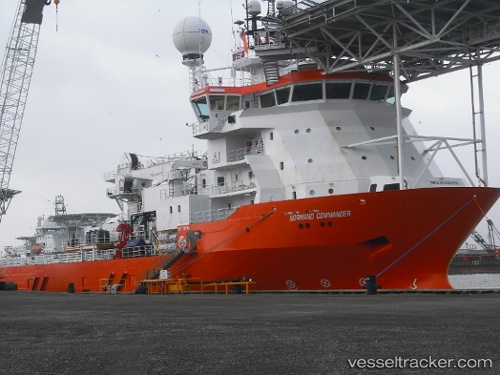
 NORMAND COMMANDER
Current Status
Where is the vessel?
NORMAND COMMANDER is currently in 73 nm N of Cidade de Angra dos Reis FPSO, based on AIS data received less than 1h ago.
Latest AIS update:
Current position: 24.32454° S, 42.68861° W (73 nm N of Cidade de Angra dos Reis FPSO)
Average speed (last 7 days): Loading…
Average speed (last 30 days): Loading…
Vessel profile: NORMAND COMMANDER is a Multi Purpose Offshore Vessel with dimensions m x m.
This page combines live AIS, route history, probable destination signals, nearby traffic, and port activity for practical vessel monitoring.
The current position of vessel NORMAND COMMANDER is -24.32454 lat / -42.68861 lng. Updated: 2026-04-18 20:06:24 UTCNearest reference points:
- 69 nm NE of Cidade de Angra dos Reis FPSO
- 49 nm S of SEPETIBA
- 27 nm SW of Santos Dumont Apt/Rio de Janeiro
Details:
Live Vessel NORMAND COMMANDER Analytics (details, animations, etc.)
Recent AIS points (UTC):
2026-04-18 14:16:45 UTC · -24.32333, -42.68833 · SOG 0 kn · COG -1°2026-04-18 15:37:36 UTC · -24.32462, -42.68939 · SOG 0 kn · COG -1°
2026-04-18 18:24:13 UTC · -24.32468, -42.68955 · SOG 0.2 kn · COG -1°
2026-04-18 20:06:24 UTC · -24.32454, -42.68861 · SOG 0.2 kn · COG -1°