 vesseltracker.com
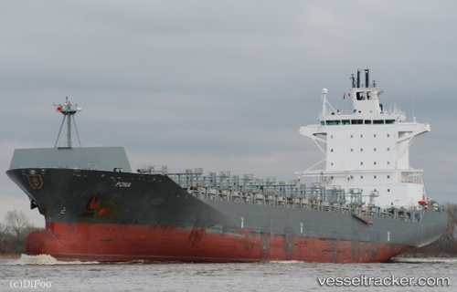
 PONA
PONA
Current Status
Where is the vessel?
PONA is currently in 71 nm SE of Lenard Harbour, based on AIS data received less than 1h ago.
Latest AIS update:
Current position: 54.02854° N, 161.62350° W (71 nm SE of Lenard Harbour)
Average speed (last 7 days): Loading…
Average speed (last 30 days): Loading…
Vessel profile: PONA is a Container Ship with dimensions 30m x 222m.
This page combines live AIS, route history, probable destination signals, nearby traffic, and port activity for practical vessel monitoring.
The current position of vessel PONA is 54.02854 lat / -161.62350 lng. Updated: 2026-04-22 23:51:12 UTCNearest reference points:
- Near Lenard Harbour
Currently sailing under the flag of Liberia ![]()
PONA built in 2007 year
Deadweight:
37905 tDetails:
Live Vessel PONA Analytics (details, animations, etc.)
Recent AIS points (UTC):
2026-04-22 19:57:21 UTC · 53.73646, -159.62152 · SOG 19 kn · COG 280°2026-04-22 21:32:06 UTC · 53.83207, -160.44537 · SOG 19.3 kn · COG 279°
2026-04-22 23:00:38 UTC · 53.95450, -161.20430 · SOG 18.7 kn · COG 283°
2026-04-22 23:51:12 UTC · 54.02854, -161.62350 · SOG 18.7 kn · COG 283°