 vesseltracker.com
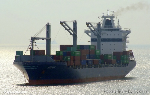
 Bomar Hermes
Current Status
Where is the vessel?
Bomar Hermes is currently in 15 nm E of Port Elizabeth, based on AIS data received about 1h ago.
Latest AIS update:
Current position: 33.88740° S, 26.01902° E (15 nm E of Port Elizabeth)
Average speed (last 7 days): Loading…
Average speed (last 30 days): Loading…
Vessel profile: Bomar Hermes is a Container Ship with dimensions 212m x 212m.
This page combines live AIS, route history, probable destination signals, nearby traffic, and port activity for practical vessel monitoring.
The current position of vessel Bomar Hermes is -33.88740 lat / 26.01902 lng. Updated: 2026-03-28 03:55:04 UTCNearest reference points:
- Near Deal Party
- 21 nm S of Mount Pleasant
Currently sailing under the flag of Liberia ![]()
Bomar Hermes built in 2006 year
Deadweight:
34365 tDetails:
Live Vessel Bomar Hermes Analytics (details, animations, etc.)
Recent AIS points (UTC):
2026-03-27 22:22:30 UTC · -33.49633, 27.34026 · SOG 14 kn · COG 236°2026-03-28 00:23:19 UTC · -33.72573, 26.89535 · SOG 12.9 kn · COG 250°
2026-03-28 01:25:19 UTC · -33.80289, 26.64649 · SOG 12.5 kn · COG 246°
2026-03-28 03:55:04 UTC · -33.88740, 26.01902 · SOG 14.9 kn · COG 273°