 vesseltracker.com
 MAX
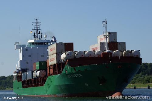
MAX
Current Status
Where is the vessel?
MAX is currently in 28 nm NW of Psará, based on AIS data received about 1h ago.
Latest AIS update:
Current position: 38.90859° N, 25.20978° E (28 nm NW of Psará)
Average speed (last 7 days): Loading…
Average speed (last 30 days): Loading…
Vessel profile: MAX is a General Cargo Ship with dimensions 127m x 20m.
This page combines live AIS, route history, probable destination signals, nearby traffic, and port activity for practical vessel monitoring.
The current position of vessel MAX is 38.90859 lat / 25.20978 lng. Updated: 2026-03-25 08:09:51 UTCNearest reference points:
- 29 nm SW of Sigri Lesvou
- 28 nm NW of Psará
- 16 nm E of Skíros
Currently sailing under the flag of Liberia ![]()
MAX built in 2006 year
Deadweight:
8723 tDetails:
Live Vessel MAX Analytics (details, animations, etc.)
Recent AIS points (UTC):
2026-03-25 01:22:34 UTC · 40.02678, 26.16470 · SOG 14.3 kn · COG 259°2026-03-25 04:06:38 UTC · 39.64494, 25.67815 · SOG 12.4 kn · COG 203°
2026-03-25 05:35:42 UTC · 39.37097, 25.50735 · SOG 12.1 kn · COG 205°
2026-03-25 08:09:51 UTC · 38.90859, 25.20978 · SOG 12 kn · COG 203°