 vesseltracker.com
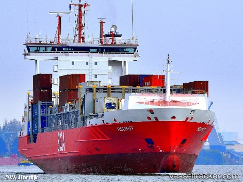
 Helmut
Current Status
Where is the vessel?
Helmut is currently in 69 nm N of TAN TAN, based on AIS data received about 1h ago.
Latest AIS update:
Current position: 29.57833° N, 11.75350° W (69 nm N of TAN TAN)
Average speed (last 7 days): Loading…
Average speed (last 30 days): Loading…
Vessel profile: Helmut is a Container Ship with dimensions m x m.
This page combines live AIS, route history, probable destination signals, nearby traffic, and port activity for practical vessel monitoring.
The current position of vessel Helmut is 29.57833 lat / -11.75350 lng. Updated: 2026-04-20 11:43:43 UTCNearest reference points:
- 84 nm NE of ORZOLA
- 120 nm W of Anza
- 125 nm W of Essaouira
Currently sailing under the flag of Portugal ![]()
Helmut built in 2006 year
Deadweight:
11272 tDetails:
Live Vessel Helmut Analytics (details, animations, etc.)
Recent AIS points (UTC):
2026-04-20 08:04:04 UTC · 29.27250, -12.52050 · SOG 11.8 kn · COG 65°2026-04-20 10:25:55 UTC · 29.47117, -12.02417 · SOG 12.2 kn · COG 67°
2026-04-20 10:52:13 UTC · 29.50583, -11.93133 · SOG 12 kn · COG 67°
2026-04-20 11:43:43 UTC · 29.57833, -11.75350 · SOG 12 kn · COG 67°