 vesseltracker.com
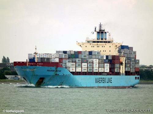
Maersk Batam
Current StatusWhere is the vessel?
Maersk Batam is currently in 12 nm NE of Hunsdon, based on AIS data received about 1h ago.
Latest AIS update:
Current position: 51.91057° N, 3.51496° E (12 nm NE of Hunsdon)
Average speed (last 7 days): Loading…
Average speed (last 30 days): Loading…
Vessel profile: Maersk Batam is a Container Ship with dimensions 32m x 223m.
This page combines live AIS, route history, probable destination signals, nearby traffic, and port activity for practical vessel monitoring.
The current position of vessel Maersk Batam is 51.91057 lat / 3.51496 lng. Updated: 2026-03-26 19:21:39 UTCNearest reference points:
- 12 nm NE of Hunsdon
- Near Hunsdon
- Near NEELTJE JANS
Details:
Live Vessel Maersk Batam Analytics (details, animations, etc.)
Recent AIS points (UTC):
2026-03-26 13:51:36 UTC · 51.90841, 3.51036 · SOG 0.1 kn · COG 359°2026-03-26 15:42:55 UTC · 51.90843, 3.51238 · SOG 0.1 kn · COG -1°
2026-03-26 17:30:40 UTC · 51.90893, 3.51390 · SOG 0 kn · COG 315°
2026-03-26 19:21:39 UTC · 51.91057, 3.51496 · SOG 0 kn · COG 288°