 vesseltracker.com
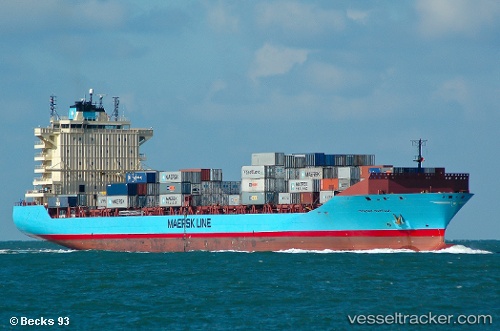
 Maersk Norfolk
Current Status
Where is the vessel?
Maersk Norfolk is currently in 51 nm W of Ras Silata, based on AIS data received less than 1h ago.
Latest AIS update:
Current position: 34.37760° N, 34.62552° E (51 nm W of Ras Silata)
Average speed (last 7 days): Loading…
Average speed (last 30 days): Loading…
Vessel profile: Maersk Norfolk is a Container Ship with dimensions 211m x 30m.
This page combines live AIS, route history, probable destination signals, nearby traffic, and port activity for practical vessel monitoring.
The current position of vessel Maersk Norfolk is 34.37760 lat / 34.62552 lng. Updated: 2026-03-30 06:25:42 UTCNearest reference points:
- Near DBAIYEH
- 31 nm SE of Vasilikos
- Near Zouk
Currently sailing under the flag of Denmark ![]()
Maersk Norfolk built in 2008 year
Deadweight:
35205 tDetails:
Live Vessel Maersk Norfolk Analytics (details, animations, etc.)
Recent AIS points (UTC):
2026-03-29 23:43:10 UTC · 33.18810, 34.55462 · SOG 10.2 kn · COG 2°2026-03-30 01:05:27 UTC · 33.42914, 34.56859 · SOG 9.9 kn · COG 1°
2026-03-30 03:15:27 UTC · 33.80175, 34.59603 · SOG 10.6 kn · COG 356°
2026-03-30 06:25:42 UTC · 34.37760, 34.62552 · SOG 10.9 kn · COG 357°