 vesseltracker.com
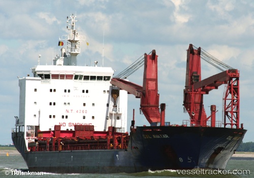
 NORDIC KYLIE
Current Status
Where is the vessel?
NORDIC KYLIE is currently in Open sea (no nearby ports in database), based on AIS data received less than 1h ago.
Latest AIS update:
Current position: 17.49316° N, 176.80179° E (Open sea (no nearby ports in database))
Average speed (last 7 days): Loading…
Average speed (last 30 days): Loading…
Vessel profile: NORDIC KYLIE is a General Cargo Ship with dimensions 138m x 21m.
This page combines live AIS, route history, probable destination signals, nearby traffic, and port activity for practical vessel monitoring.
The current position of vessel NORDIC KYLIE is 17.49316 lat / 176.80179 lng. Updated: 2026-03-29 18:07:03 UTCNearest reference points:
- Open sea (no nearby ports in database)
- Open sea, approx. 551 nm off the nearest listed port
- Open sea, approx. 543 nm off the nearest listed port
Currently sailing under the flag of Liberia ![]()
NORDIC KYLIE built in 2005 year
Deadweight:
12760 tDetails:
Live Vessel NORDIC KYLIE Analytics (details, animations, etc.)
Recent AIS points (UTC):
2026-03-29 12:02:17 UTC · 17.50513, 178.42865 · SOG 14.8 kn · COG 268°2026-03-29 13:26:28 UTC · 17.49493, 178.05197 · SOG 15.7 kn · COG 269°
2026-03-29 16:23:37 UTC · 17.49667, 177.27667 · SOG 15 kn · COG -1°
2026-03-29 18:07:03 UTC · 17.49316, 176.80179 · SOG 15.5 kn · COG 271°