 vesseltracker.com
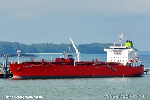
 GULF HUWAYLAT
Current Status
Where is the vessel?
GULF HUWAYLAT is currently in 78 nm W of Casselton, based on AIS data received about 22h ago.
Latest AIS update:
Current position: 47.20528° N, 14.49852° W (78 nm W of Casselton)
Average speed (last 7 days): Loading…
Average speed (last 30 days): Loading…
Vessel profile: GULF HUWAYLAT is a Oil/Chemical Tanker with dimensions m x m.
This page combines live AIS, route history, probable destination signals, nearby traffic, and port activity for practical vessel monitoring.
The current position of vessel GULF HUWAYLAT is 47.20528 lat / -14.49852 lng. Updated: 2026-04-10 05:40:16 UTCNearest reference points:
- 24 nm N of Aurach Bei Kitzbuhel
Currently sailing under the flag of Panama ![]()
Details:
Live Vessel GULF HUWAYLAT Analytics (details, animations, etc.)
Recent AIS points (UTC):
2026-04-10 00:22:21 UTC · 46.80723, -15.97633 · SOG 12.1 kn · COG 71°2026-04-10 04:11:16 UTC · 47.09597, -14.92085 · SOG 12.3 kn · COG 73°
2026-04-10 05:12:37 UTC · 47.17232, -14.62993 · SOG 12.4 kn · COG 73°
2026-04-10 05:40:16 UTC · 47.20528, -14.49852 · SOG 12.5 kn · COG 72°