 vesseltracker.com
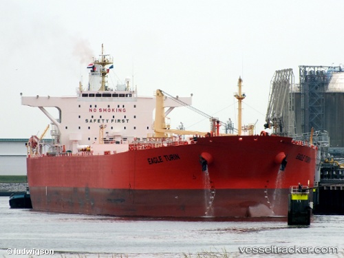
 SARGODHA
Current Status
Where is the vessel?
SARGODHA is currently in Near Karachi, based on AIS data received less than 1h ago.
Latest AIS update:
Current position: 24.80588° N, 66.97733° E (Near Karachi)
Average speed (last 7 days): Loading…
Average speed (last 30 days): Loading…
Vessel profile: SARGODHA is a Crude Oil Tanker with dimensions 246m x 42m.
This page combines live AIS, route history, probable destination signals, nearby traffic, and port activity for practical vessel monitoring.
The current position of vessel SARGODHA is 24.80588 lat / 66.97733 lng. Updated: 2026-04-19 16:54:30 UTCNearest reference points:
- Near Kiamari
- 16 nm S of Kiamari
- Near PORT QASIM
Currently sailing under the flag of Pakistan ![]()
SARGODHA built in 2008 year
Deadweight:
107123 tDetails:
Live Vessel SARGODHA Analytics (details, animations, etc.)
Recent AIS points (UTC):
2026-04-19 13:02:55 UTC · 24.80585, 66.97731 · SOG 0.1 kn · COG 339°2026-04-19 13:30:46 UTC · 24.80593, 66.97732 · SOG 0.1 kn · COG -1°
2026-04-19 16:23:55 UTC · 24.80589, 66.97734 · SOG 0 kn · COG 339°
2026-04-19 16:54:30 UTC · 24.80588, 66.97733 · SOG 0 kn · COG -1°