 vesseltracker.com
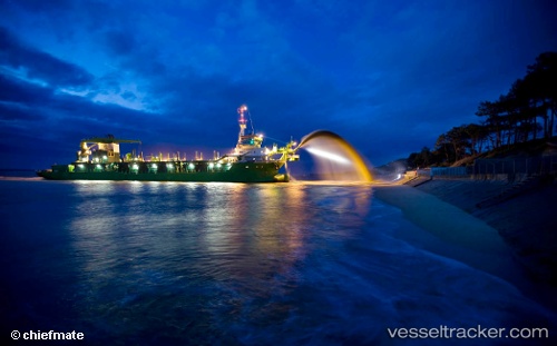
Marieke
Current StatusWhere is the vessel?
Marieke is currently in Near TAICHUNG, based on AIS data received about 1h ago.
Latest AIS update:
Current position: 24.24948° N, 120.48228° E (Near TAICHUNG)
Average speed (last 7 days): Loading…
Average speed (last 30 days): Loading…
Vessel profile: Marieke is a Hopper Dredger with dimensions 22m x 98m.
This page combines live AIS, route history, probable destination signals, nearby traffic, and port activity for practical vessel monitoring.
The current position of vessel Marieke is 24.24948 lat / 120.48228 lng. Updated: 2026-03-28 00:13:26 UTCNearest reference points:
- Near TAICHUNG
- Near Tai-tung Kang
- Near Miao-li
Details:
Live Vessel Marieke Analytics (details, animations, etc.)
Recent AIS points (UTC):
2026-03-27 17:49:26 UTC · 24.24805, 120.48142 · SOG 2.1 kn · COG 20°2026-03-27 19:52:25 UTC · 24.25071, 120.48571 · SOG 0.7 kn · COG 126°
2026-03-27 21:50:18 UTC · 24.24946, 120.48230 · SOG 1.3 kn · COG 30°
2026-03-28 00:13:26 UTC · 24.24948, 120.48228 · SOG 1 kn · COG 24°