 vesseltracker.com
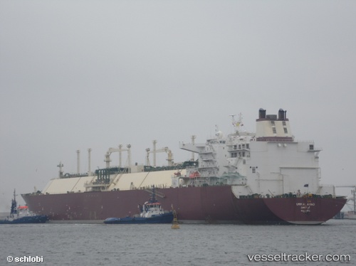
 Umm Al Amad
Current Status
Where is the vessel?
Umm Al Amad is currently in 18 nm SW of Halul Island, based on AIS data received about 1d ago.
Latest AIS update:
Current position: 25.47609° N, 52.21305° E (18 nm SW of Halul Island)
Average speed (last 7 days): Loading…
Average speed (last 30 days): Loading…
Vessel profile: Umm Al Amad is a Lng Tanker with dimensions 315m x 50m.
This page combines live AIS, route history, probable destination signals, nearby traffic, and port activity for practical vessel monitoring.
The current position of vessel Umm Al Amad is 25.47609 lat / 52.21305 lng. Updated: 2026-04-10 06:55:38 UTCNearest reference points:
- Near RAS LAFFAN
- 21 nm NE of Halul Island
- Near Das Island
Currently sailing under the flag of Marshall Is ![]()
Umm Al Amad built in 2008 year
Deadweight:
121730 tDetails:
Live Vessel Umm Al Amad Analytics (details, animations, etc.)
Recent AIS points (UTC):
2026-04-10 02:27:15 UTC · 25.47906, 52.21611 · SOG 0 kn · COG 174°2026-04-10 03:57:15 UTC · 25.47888, 52.21745 · SOG 0 kn · COG 210°
2026-04-10 06:23:23 UTC · 25.47539, 52.21460 · SOG 0.3 kn · COG 46°
2026-04-10 06:55:38 UTC · 25.47609, 52.21305 · SOG 0.3 kn · COG -1°