 vesseltracker.com
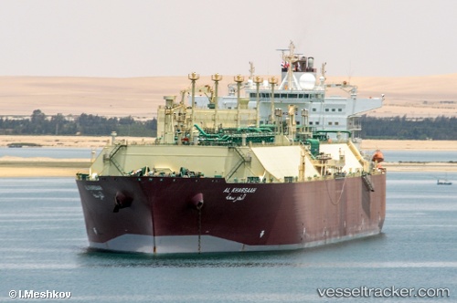
 Al Kharsaah
Current Status
Where is the vessel?
Al Kharsaah is currently in 74 nm SE of Summerstrand, based on AIS data received less than 1h ago.
Latest AIS update:
Current position: 34.95271° S, 26.57037° E (74 nm SE of Summerstrand)
Average speed (last 7 days): Loading…
Average speed (last 30 days): Loading…
Vessel profile: Al Kharsaah is a Lng Tanker with dimensions 315m x 50m.
This page combines live AIS, route history, probable destination signals, nearby traffic, and port activity for practical vessel monitoring.
The current position of vessel Al Kharsaah is -34.95271 lat / 26.57037 lng. Updated: 2026-04-17 03:47:45 UTCNearest reference points:
- 21 nm S of Mount Pleasant
- Near Deal Party
Currently sailing under the flag of Bahamas ![]()
Al Kharsaah built in 2008 year
Deadweight:
109484 tDetails:
Live Vessel Al Kharsaah Analytics (details, animations, etc.)
Recent AIS points (UTC):
2026-04-16 22:22:03 UTC · -34.98035, 25.12438 · SOG 12.2 kn · COG 85°2026-04-17 00:18:40 UTC · -34.97307, 25.62056 · SOG 12.9 kn · COG 85°
2026-04-17 02:40:00 UTC · -34.96077, 26.25434 · SOG 13.8 kn · COG 83°
2026-04-17 03:47:45 UTC · -34.95271, 26.57037 · SOG 13.6 kn · COG 86°