 vesseltracker.com
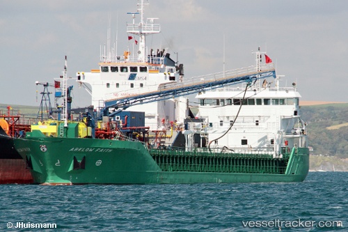
 NICOLA L
Current Status
Where is the vessel?
NICOLA L is currently in 17 nm NW of Ile D’Ouessant, based on AIS data received about 1h ago.
Latest AIS update:
Current position: 48.91972° N, 5.66873° W (17 nm NW of Ile D’Ouessant)
Average speed (last 7 days): Loading…
Average speed (last 30 days): Loading…
Vessel profile: NICOLA L is a General Cargo with dimensions m x m.
This page combines live AIS, route history, probable destination signals, nearby traffic, and port activity for practical vessel monitoring.
The current position of vessel NICOLA L is 48.91972 lat / -5.66873 lng. Updated: 2026-04-18 21:27:38 UTCNearest reference points:
- 16 nm NW of Ile D’Ouessant
- 18 nm NE of Ile D’Ouessant
- 28 nm S of Porthgwarra
Currently sailing under the flag of Antigua and Barbuda ![]()
Details:
Live Vessel NICOLA L Analytics (details, animations, etc.)
Recent AIS points (UTC):
2026-04-18 15:22:57 UTC · 49.37756, -4.58776 · SOG 7.5 kn · COG 241°2026-04-18 17:27:18 UTC · 49.25115, -4.90808 · SOG 6.9 kn · COG 244°
2026-04-18 20:15:43 UTC · 49.04167, -5.40500 · SOG 10 kn · COG -1°
2026-04-18 21:27:38 UTC · 48.91972, -5.66873 · SOG 10.9 kn · COG 239°