 vesseltracker.com
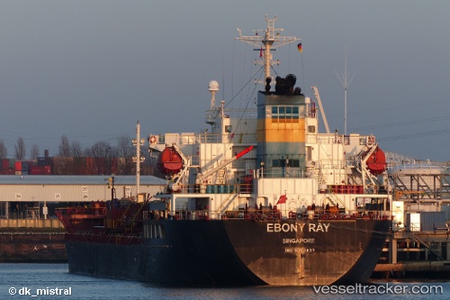
 Ebony Ray
Current Status
Where is the vessel?
Ebony Ray is currently in Near Singapore, based on AIS data received about 2h ago.
Latest AIS update:
Current position: 1.21599° N, 103.81295° E (Near Singapore)
Average speed (last 7 days): Loading…
Average speed (last 30 days): Loading…
Vessel profile: Ebony Ray is a Chemical Oil Products Tanker with dimensions 145m x 24m.
This page combines live AIS, route history, probable destination signals, nearby traffic, and port activity for practical vessel monitoring.
The current position of vessel Ebony Ray is 1.21599 lat / 103.81295 lng. Updated: 2026-04-04 01:35:50 UTCNearest reference points:
- Near Singapore
- Near BUKOM ISLAND
- Near Pasir Panjang Wharves
Currently sailing under the flag of Singapore ![]()
Ebony Ray built in 2008 year
Deadweight:
19998 tDetails:
Live Vessel Ebony Ray Analytics (details, animations, etc.)
Recent AIS points (UTC):
2026-04-03 19:47:51 UTC · 1.21566, 103.81520 · SOG 0 kn · COG 325°2026-04-03 22:11:46 UTC · 1.21548, 103.81514 · SOG 0 kn · COG 330°
2026-04-03 23:59:49 UTC · 1.21517, 103.81378 · SOG 0 kn · COG 28°
2026-04-04 01:35:50 UTC · 1.21599, 103.81295 · SOG 0 kn · COG 85°