 vesseltracker.com
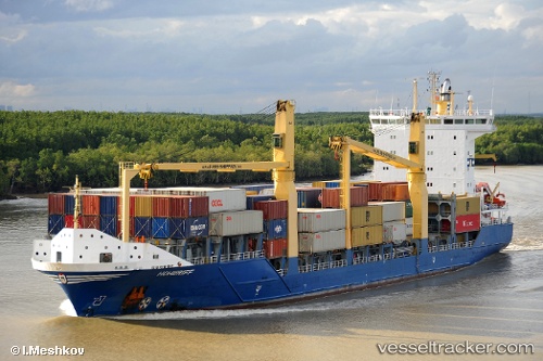
 ARTEMIS
Current Status
Where is the vessel?
ARTEMIS is currently in Near Lafiteau, based on AIS data received about 1d ago.
Latest AIS update:
Current position: 18.67736° N, 72.38101° W (Near Lafiteau)
Average speed (last 7 days): Loading…
Average speed (last 30 days): Loading…
Vessel profile: ARTEMIS is a Container Ship with dimensions 23m x 140m.
This page combines live AIS, route history, probable destination signals, nearby traffic, and port activity for practical vessel monitoring.
The current position of vessel ARTEMIS is 18.67736 lat / -72.38101 lng. Updated: 2026-04-03 22:03:06 UTCNearest reference points:
- Near Bahia De Las Calderas
- Near Puerto Plata
- 56 nm SW of Cockburn Harbour
Currently sailing under the flag of Latvia ![]()
ARTEMIS built in 2007 year
Deadweight:
11807 tDetails:
Live Vessel ARTEMIS Analytics (details, animations, etc.)
Recent AIS points (UTC):
2026-04-03 19:27:45 UTC · 18.69304, -72.36398 · SOG 0 kn · COG -1°2026-04-03 20:42:15 UTC · 18.69307, -72.36401 · SOG 0 kn · COG -1°
2026-04-03 22:03:06 UTC · 18.67736, -72.38101 · SOG 10.8 kn · COG -1°
2026-04-03 22:03:06 UTC · 18.67736, -72.38101 · SOG 10.8 kn · COG -1°